
Tracing a Birmingham Street Address
A Birmingham street directory search works outward from one deliverable address. Begin with the current USPS form, then use Oakland County Property Gateway to find the PIN or parcel. The property record can identify the land-administration trail. Next, take the address, subdivision, PIN, or name into the Oakland Super Index. The deed index provides parties to a recorded transaction, not a present-occupant list. Finally, use dated voter, directory, newspaper, or civic records only for the precise role they display.
Each step can change the next. A historic directory may use Woodward, Old Woodward, or Hunter Boulevard. A current street address often uses 48009, while a Birmingham Post Office or municipal mailing format may use 48012. Keep the original printed address, USPS-normalized address, PIN, historic street form, source, and date side by side instead of forcing them into one label.
- Confirm the current delivery form with the USPS ZIP Code Lookup.
- Search the address or PIN in Oakland County Property Gateway and record the parcel identifier.
- Open the same location in the City GIS Viewer for map and neighborhood context, noting that its exact public fields were not verified.
- Search the Super Index by address, party, subdivision, document type, or recorded date, then save the instrument number.
- Use a date-specific directory, newspaper, or voter result as a separate household lead, never as a substitute for the land record.
Birmingham Street Directory Fields
Oakland County Property Gateway is the street directory’s main parcel lookup. It accepts an address, PIN, partial address, partial PIN, multiple comma-separated PINs, or a map click. The published instructions set a five-character minimum and use percent signs for wildcard patterns. They give 1200 S, 123 S V, 1% Main, 1% S% M, and 14011% as generic portal examples. Do not mistake those examples for Birmingham property values.
| Search field or control | Portal use | Street-search value |
|---|---|---|
| PIN | Full, partial, or multiple values | Connects address work to a parcel |
| Property address | Full or partial string with wildcard support | Finds candidates along a street |
| Map click | Selects a mapped property | Checks an address against local map context |
| Reports, cart, and print choices | Map/report product workflow | Preserves a requested parcel output |
Property Gateway data come from multiple municipalities, and classification or update schedules can differ. Use it to identify a parcel, then compare the result with the tax portal and recorded document index.
The Property Gateway screen shows the Birmingham address and PIN entry route. 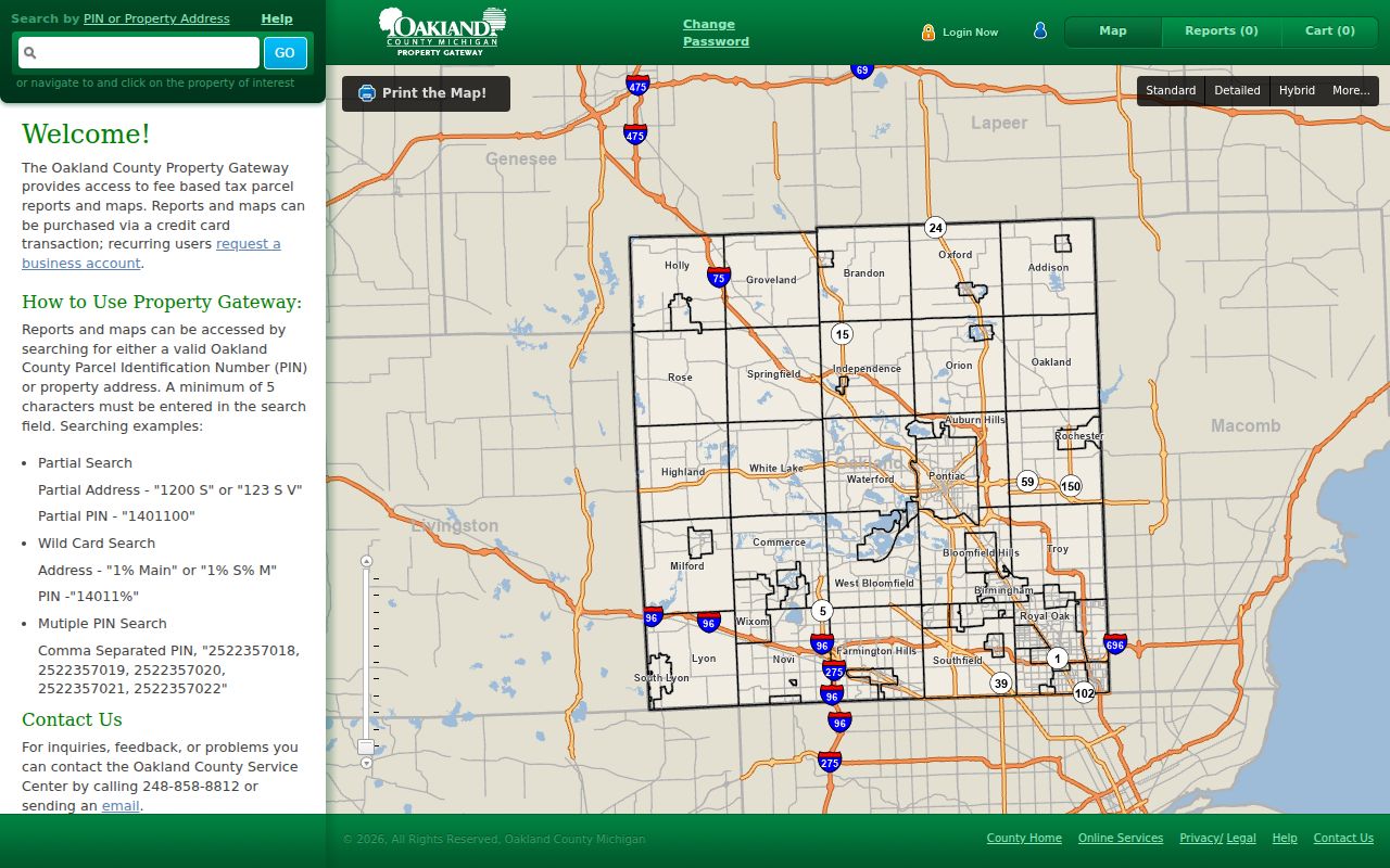
Its search choices make the parcel number the useful bridge when a street form has changed.
Birmingham Streets in Super Index
The Oakland Super Index can search simple name, address, subdivision, and document-type terms, then refine the result by document type, recorded year, Grantor, or Grantee. Its advanced route includes Grantor/Grantee, recorded or file date, instrument number, document type, subdivision, block, and lot. Results show document type, date recorded, PIN, Grantor, and Grantee. The tabs, All Results, Names Only, Index Only, and Text Only, serve different review needs.
Online recorded-document coverage starts January 1, 1964, except for subdivision plat maps. The free index is the appropriate first pass. A document image moves through the cart and can involve the published $5 transaction fee, $1 for up to three pages, then $0.50 per additional page, capped at $50 per document. Before an order, compare the indexed party names, PIN, recording date, document type, and instrument number. Pre-1964 guidance comes from the Register of Deeds, older books or microfilm, and archival staff because the reviewed source did not specify a complete older inventory.
Note: a tax or deed owner can differ from a current occupant, and neither label should be substituted for the other.
Birmingham Street Name Variants
Street forms are a real search issue in Birmingham. Test Woodward Avenue, Old Woodward Avenue, Hunter Boulevard, abbreviations, and the house number when a historic result does not match a current one. Research located a secondary account of the bypass naming and original-section renaming, but not an official municipal ordinance that supports a definitive renaming year. Record the variant used rather than presenting an unverified date as fact.
The Oakland County Historical Society has a 1911 Detroit street and house-number guide plus a 1919 directory of residents on R.F.D. routes near Pontiac, Birmingham, and Farmington. These are targeted historical normalization leads, not a complete conversion table. Pair any old address with a directory or newspaper and a deed, map, census, tax, cemetery, or municipal document. A current PIN can be a stronger bridge than a street label alone.
Birmingham Records by Street
Address-keyed records complement one another in Birmingham. The parcel and tax routes describe land administration. The City GIS Viewer adds local map context, although its live fields and layer inventory were not verified in the research. The Super Index names parties to recorded documents. The public voter route checks registration information for a specific name with required birth fields. City permit forms establish that a building or inspection record may exist, but the live BS&A search fields, coverage years, and public image access were not verified.
| Record Set | Keeper | What It Shows | Access |
|---|---|---|---|
| Property Gateway | Oakland County | PIN, address search, parcel mapping route | Online search; reports/maps may be paid |
| County tax portal | Oakland County | Municipality plus parcel ID, or street and municipality | Interactive route; statement products may carry fees |
| City GIS Viewer | City of Birmingham | Local map and parcel context | Public JavaScript viewer; field inventory unverified |
| Super Index | Oakland Clerk/Register of Deeds | Recorded parties, PIN, date, document type | Free index; paid document order |
| City building records | Birmingham Building Department | Linked permit and inspection form categories | Online forms, City contact, or FOIA for existing records |
The PIN or legal description is the best link between a parcel record and a recorded document. A street string should be retained exactly as shown by each source, especially when working with older numbering or a historic street term. For full-period directory holdings rather than modern address records, use the Birmingham city-directory collection rather than expecting the map or deed index to supply household names.
Birmingham Street Map Checks
The City GIS Viewer is a local street-directory companion, not a source for unverified attributes. Its browser interface was available as a public mapping target, but text research could not confirm the exact search controls, layer names, popup fields, dates, or export choices. Use an observed map screen to understand local layout, then obtain ownership, tax, or recorded-document facts from the Oakland system that keeps them.
Oakland County mapping services offers property maps, historic and current aerial imagery, elevation contours, FEMA DFIRM, and custom parcel, tax, or assessing data by appointment. Its contact route is 248-858-0750 or edevmaps@oakgov.com. That office is the fallback when the public map does not answer a precise historical or parcel question.
Open the Birmingham GIS Viewer for the live map context. 
The captured map interface should be read with the recorded source date and parcel identifier, not as a household roster.
Birmingham Street Voter Checks
The Michigan Voter Information Center has no documented street-wide public list in the researched interface. It asks for first name, last name, birth month, and birth year, and may return voter registration, polling, ballot, and election information. A public voter entry is a dated election record, not a direct proof of present occupancy. The state’s public voter-file structure has further limits, including exclusions for phone number, full birth date, and driver-license or state-ID number.
For a larger request, use the Michigan Department of State FOIA/QVF form with a defined scope and format request. Birmingham’s City Clerk also assists voters and accepts several voter forms through the south-side drop box. The City Clerk election contacts are 248-530-1804 and 248-530-1880. Michigan Address Confidentiality Program participants have protected handling, so a designated address must never be treated as a physical residence.
Check the Michigan Voter Information Center for its public individual search. 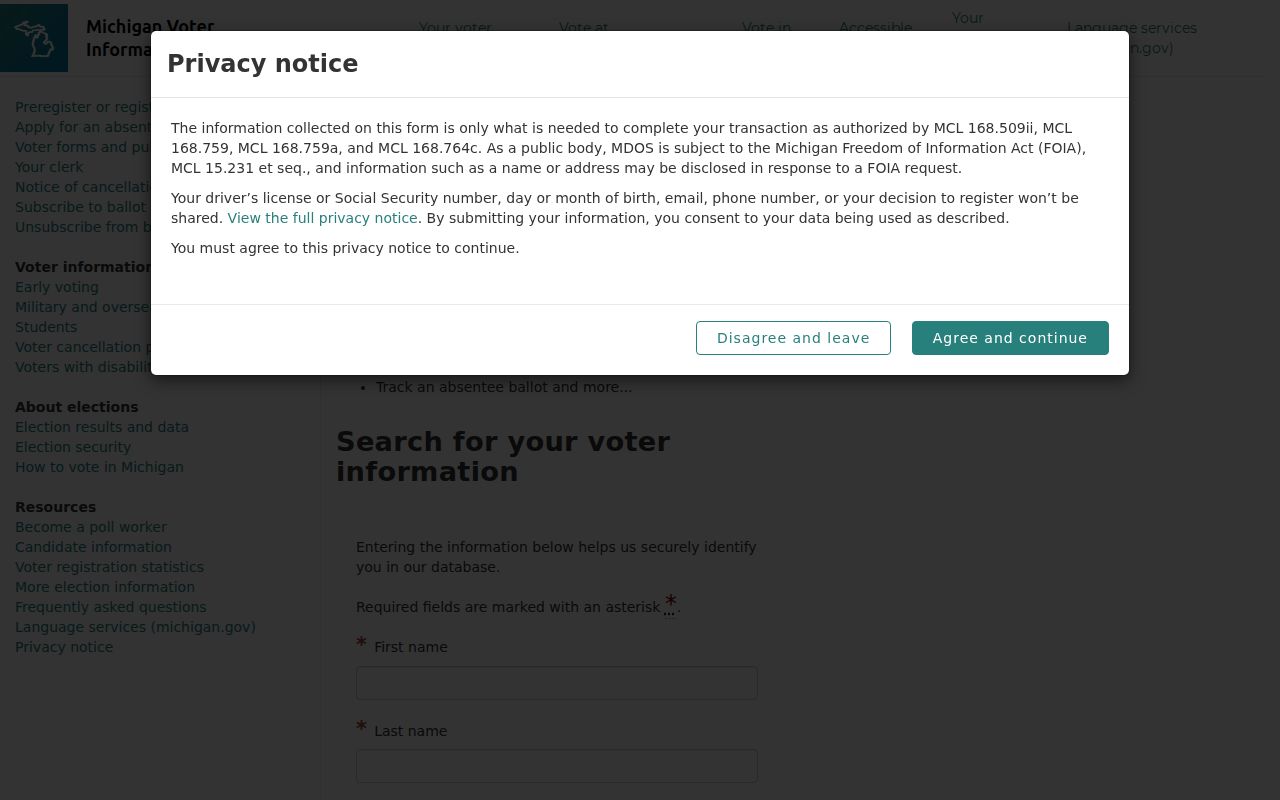
The visible form confirms that name and birth fields, not a street-browse control, define this public lookup.
Birmingham Address Records Offline
When an address record is not indexed online, use the custodian instead of guessing from a search snippet. City Hall, the Register of Deeds, Baldwin Public Library, Birmingham Museum, the Oakland County Historical Society, and the Library of Michigan provide distinct counter, phone, email, research-appointment, library, archive, or scan-request routes. Birmingham’s City Clerk accepts in-person, mail, fax, email, and drop-box submissions for several forms. Its FOIA form allows inspection, copies, pickup, onsite copying, mail, and email delivery.
A focused Birmingham FOIA request should state the record type, date range, property address, Sidwell number, meeting body, or permit number. Under Michigan FOIA, MCL 15.231 et seq., a public body generally responds within five business days and may extend by ten business days. The City form describes a potential 50 percent deposit for estimates above $50 and an indigence affidavit route. Ask for an existing record and expect lawful redactions where they apply.
Birmingham Street Directory Terms
Street research becomes clearer when the underlying record terms stay separate. The same postal address can appear in a city map, a parcel card, a recorded document, and an old directory, each with a different date and purpose.
- Parcel
- A defined piece of land tracked by the county, often through a PIN.
- Situs address
- The physical property address used to locate land, which can differ from a mailing address.
- Plat
- A recorded map of a subdivision or land division; the Super Index notes plat-map exceptions to its online document coverage.
- Criss-cross directory
- An address-ordered directory section that can identify a past household reference on one street.
Birmingham Historic Street Evidence
For an older Birmingham address, move from the current parcel backward through sources that carry a date. The Oakland County Historical Society confirms Polk’s Birmingham directory volumes for 1937, 1949, 1954, 1957, 1959, 1969, 1974, 1975, 1977, 1979, and 1983 through 1985, plus a Birmingham-Bloomfield Hills Community Directory for 1986. These volumes can identify a printed address and household reference for that edition, but they do not prove a continuous stay or resolve every street change.
Baldwin Public Library’s 2,149 microfilm reels include the Birmingham Eccentric, with the earliest reported issue dated May 2, 1878. Search a street form, name variants, organization, and narrow date range, then record the issue date, page, reel, headline, and type of item. The Birmingham Museum offers research services by appointment, while OCPHS can help with manuscript, property, and map leads. The Library of Congress Sanborn collection is a map route, but exact Birmingham sheets and coverage were not verified, so request or capture the relevant title and year before relying on it.
Birmingham Street Directory Limits
A street directory cannot reliably identify everyone connected with an address. Ownership, registered-agent status, public voter status, a recorded party, mail recipient, association contact, and occupant are different roles. Postal ZIPs do not set city limits, parcel geometry does not prove association membership, and a government address can be an Address Confidentiality Program substitute. An apparent absence can also result from an unindexed historic record, a protected category, a later street change, or a portal’s coverage date.
Use official domains and known custodian contacts. Oakland has warned of unofficial deed-record and home-warranty postcards that ask for money. A cart or fee screen is not a deed, and a name hit is not identity proof. Compare a date, parcel, instrument number, case number, relationship, or other independent anchor. Do not bypass confidentiality, access controls, archive restrictions, or portal limits.
Lawful use. Birmingham street and address records are for legitimate personal, family-history, estate, civic, and safety research. Never use them to stalk, harass, intimidate, or expose a protected address.